Property Record
305 S Burnet Ave S, Syracuse, NY 13203
NEARBY LISTINGS FOR SALE OR LEASE
-
-
View all Syracuse listings for sale on LoopNet.com
Property Detail
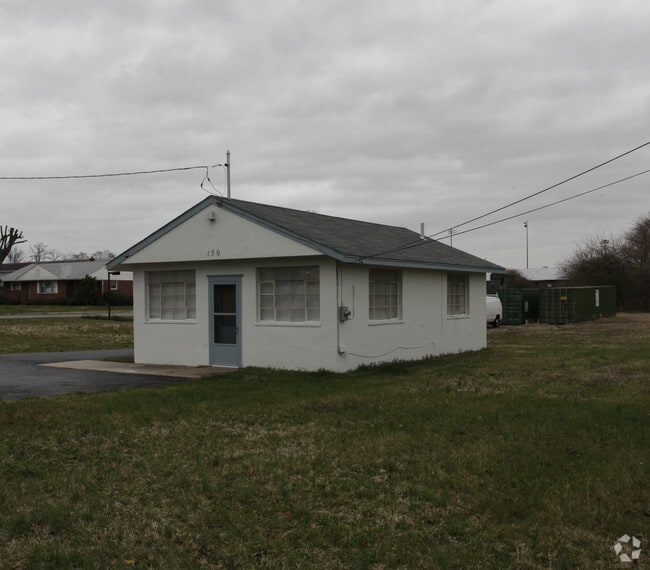
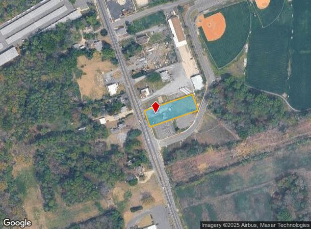
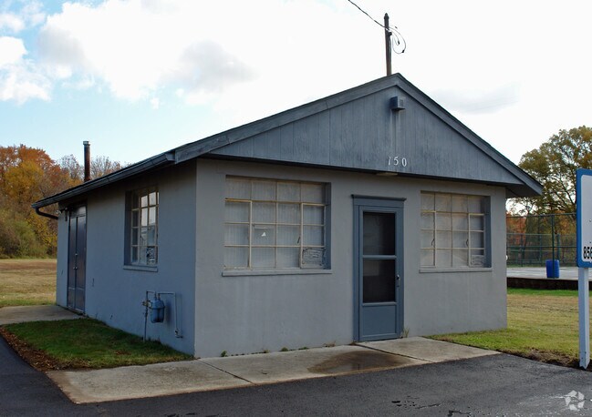
305 S Burnet Ave S
Philadelphia-Camden-Wilmington, PA-NJ-DE-MD
Gloucester
06-00427-0000-00016-01
New Jersey
Commercialnec
16.1
2024
0.69 AC
2025
Gloucester County
501402
Philadelphia
600 SF
DEMOGRAPHICS near 305 S Burnet Ave S
1 Mile
3 Mile
5 Mile
2024 Total Population
3,886
46,311
95,413
2029 Population
4,073
48,056
98,765
Pop Growth 2024-2029
+ 4.81%
+ 3.77%
+ 3.51%
Average Age
38
37
40
2024 Total Households
1,436
15,040
33,400
HH Growth 2024-2029
+ 5.01%
+ 4.22%
+ 3.74%
Median Household Inc
$54,827
$91,635
$95,974
Avg Household Size
2.40
2.60
2.60
2024 Avg HH Vehicles
2.00
2.00
2.00
Median Home Value
$210,969
$253,743
$268,918
Median Year Built
1980
1982
1981
Nearby Places
Map Layers
Map Styles
 Street
 Aerial
- Restaurants
- Banks
- Shops
- Fitness
- Groceries
PUBLIC TRANSPORTATION
AIRPORT
Philadelphia International
DRIVE
WALK
Distance
Philadelphia International
41 min
25.5 mi
Freight Ports
Broadway Terminal - Pier 5
DRIVE
WALK
Distance
Broadway Terminal - Pier 5
26 min
17.0 mi
Nearby Properties
Address
Land Use
TOTAL SIZE
Lot Size
Zoning
Address
Land Use
TOTAL SIZE
Lot Size
Zoning
96.68 AC
P
Address
Land Use
TOTAL SIZE
Lot Size
Zoning
3.34 AC
R3
Address
Land Use
TOTAL SIZE
Lot Size
Zoning
4.41 AC
Address
Land Use
TOTAL SIZE
Lot Size
Zoning
Address
Land Use
TOTAL SIZE
Lot Size
Zoning
Address
Land Use
TOTAL SIZE
Lot Size
Zoning
4.52 AC
P
Address
Land Use
TOTAL SIZE
Lot Size
Zoning
46.38 AC
P
Address
Land Use
TOTAL SIZE
Lot Size
Zoning
Address
Land Use
TOTAL SIZE
Lot Size
Zoning
25.71 AC
Address
Land Use
TOTAL SIZE
Lot Size
Zoning
Address
Land Use
TOTAL SIZE
Lot Size
Zoning
23.27 AC
C5
Address
Land Use
TOTAL SIZE
Lot Size
Zoning
26.35 AC
R4
Address
Land Use
TOTAL SIZE
Lot Size
Zoning
1.77 AC
Address
Land Use
TOTAL SIZE
Lot Size
Zoning
1.29 AC
Address
Land Use
TOTAL SIZE
Lot Size
Zoning
23.80 AC
R-B
Address
Land Use
TOTAL SIZE
Lot Size
Zoning
Address
Land Use
TOTAL SIZE
Lot Size
Zoning
Address
Land Use
TOTAL SIZE
Lot Size
Zoning
22.31 AC
C5
Address
Land Use
TOTAL SIZE
Lot Size
Zoning
14.57 AC
P
Address
Land Use
TOTAL SIZE
Lot Size
Zoning
37.40 AC
CF/I
Address
Land Use
TOTAL SIZE
Lot Size
Zoning
2.68 AC
P
Address
Land Use
TOTAL SIZE
Lot Size
Zoning
1.52 AC
Address
Land Use
TOTAL SIZE
Lot Size
Zoning
17.02 AC
PA
Address
Land Use
TOTAL SIZE
Lot Size
Zoning
7.57 AC
P
Address
Land Use
TOTAL SIZE
Lot Size
Zoning
Address
Land Use
TOTAL SIZE
Lot Size
Zoning
26.26 AC
P
Address
Land Use
TOTAL SIZE
Lot Size
Zoning
Address
Land Use
TOTAL SIZE
Lot Size
Zoning
21.14 AC
CF/I
Address
Land Use
TOTAL SIZE
Lot Size
Zoning
25.12 AC
PR3
Address
Land Use
TOTAL SIZE
Lot Size
Zoning
20.08 AC
INS
The World's #1 Commercial Real Estate Marketplace
Connect with us
© 2025 CoStar Group
The information above has been obtained from sources believed reliable. While we do not doubt its accuracy we have not verified it and make no guarantee, warranty or representation about it. It is your responsibility to independently confirm its accuracy and completeness. Any projections, opinions, assumptions, or estimates used are for example only and do not represent the current or future performance of the property. The value of this transaction to you depends on tax and other factors which should be evaluated by your tax, financial, and legal advisors. You and your advisors should conduct a careful, independent investigation of the property to determine to your satisfaction the suitability of the property for your needs.